Future Fens – Flood Risk Management


A third of the Great Ouse Fens lies within below sea level. Consequently, flood and land drainage infrastructure in the Fens is crucial in enabling surrounding agricultural land, businesses, communities, habitats and species to prosper.

‘Future Fens – Flood Risk Management’ is a programme of activity that’s been put in place to consider what the future flood risk management choices for the Great Ouse Fens might look like.

Photo credit: Paul Tibbs/Ian Burt Photography

Overview


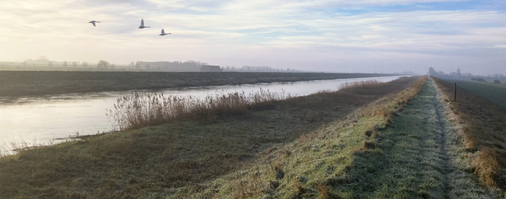
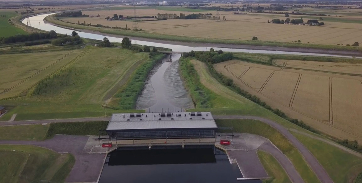
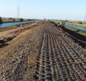
As with similar areas in the Netherlands, much of the Fens originally consisted of fresh or salt-water wetlands which were first drained in the 1600s to create valuable land for farming. Today the Great Ouse Fens has become a major agricultural region in Britain for grains and vegetables. It contains large areas of lowland wetland with unique and internationally significant wildlife, and has one of the richest legacies of flood risk and drainage management in the country.

With climate change projections, and many of the flood and water management structures in the Fens coming to the end of their design life, a strategic and long-term approach is needed. This will require changes to current flood risk and drainage activities coupled with significant investment.

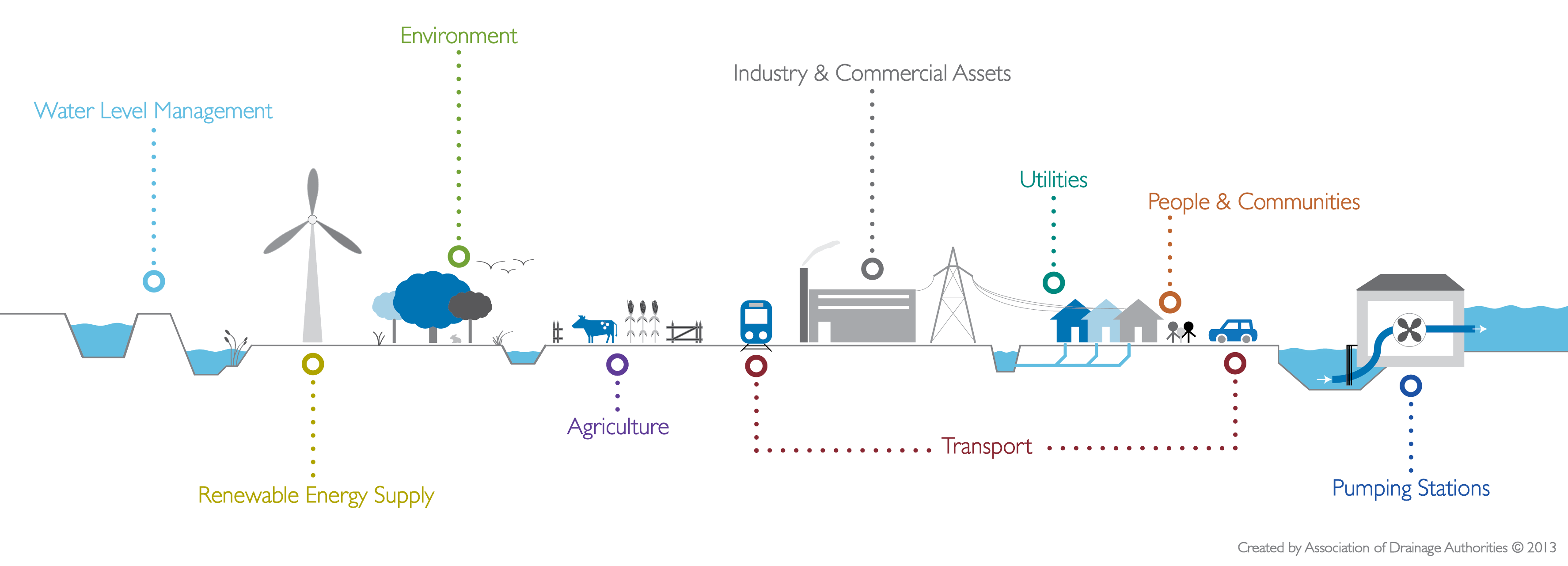
This programme is looking at the adaptive approach needed to manage this catchment to balance the needs of people, the environment and agriculture, to ensure we create the right legacy for the next 100 years. This approach will identify the decisions which need to be taken now and those that will need to be taken in the future. Utilising innovative, coordinated and sustainable solutions from landowners, businesses, planning authorities, communities and risk management authorities, to manage this landscape for the long-term.

The Great Ouse Fens in Cambridgeshire & Norfolk


The River Great Ouse is the fourth longest river in the United Kingdom, with an overall length of 230km. The catchment area for the river extends over 8,500 km2 and is home to around 1.7 million people. The Great Ouse Fens area considered here covers 2,178km2 of Cambridgeshire and Norfolk adjacent to the lower reach of the Great Ouse River from Earith to The Wash.

Timescale


With 2020 being Year 1, this is an indicative timeline for this programme of activity. There will likely be overlap in phases and aspects of work accelerated.

Investment in exiting flood assets in the Fens will continue whilst the longer term choices are being evaluated. As part of the programme of activity, the Environment Agency, IDBs and Lead Local Flood Authorities have developed and agreed ‘tactical Plans’ to support the investment case to sustain the standards of service of existing assets. Approximately £230 million of capital funding is required between now and 2031/32.

PHASE 1

Year 1 – 3

BASELINE REPORT

Understanding current situation, future challenges and establishing partnerships

PHASE 2

Years 5 – 10

OPTIONS

Testing options & choosing the preferred strategic flood risk management approach

PHASE 3

Years 10 – 15

PLANNING AND DELIVERY

Putting the strategy into action, planning & delivering flood risk management options

Phase 1 – Understanding the current situation, future challenges & establishing partnerships


St Germans Pumping Station – The largest pumping station in the UK helps manage water levels and flood risk across 70,000 hectares of the Fens.

During the first phase of this programme, organisations with flood risk assets in the Great Ouse Fens have come together and formed a Technical Group (TG) to share their understanding of the current situation and the challenges for managing future flood risk in the Great Ouse Fens, and to have shared ownership for taking action to overcome these challenges.

The TG has worked together to set out all available data about flood risk in the area to calculate:

  • Whole life costs to sustain the existing flood risk management assets
  • Benefits of the existing flood risk management assets
  • Total available Flood Risk Management Grant in Aid (Government funding)

This information has been used to highlight the difference between the funding required and the available funding.

This study is the first of three main phases in an ambitious programme that will develop options and then deliver the future flood and drainage infrastructure that will provide flood resilience in and around the Fens for future generations.

Summary of Flood Risk Management Benefits


The Great Ouse Fens comprises approximately 217,800 hectares of rural lowland, much of which is below sea level. It contains 131,000 households and 13,200 industrial and commercial properties, and 185,000 hectares of agricultural land.

Flood risk is managed through an extensive and complex network of assets including 138 pumping stations, 24 sets of sluice gates, 95km of coastal defences and 405km of fluvial embankments. Much of this infrastructure is nearing the end of its design life and will soon require significant investment.

The first phase has identified £17.1 billion worth of benefits from the current flood risk management measures, with a further £5.3 billion of gross value added to the local economy. The total investment needed over the next 100 years to sustain the current standard of service of flood risk management assets is £1.8 billion. There is an additional funding requirement from partners of between £611 million and £946 million, with between £722 million and £1.1billion of Flood Risk Management Grant in Aid (Government funding) required.

£5.3 billion

Gross Value Added to the local economy by jobs protected through FRM in the next ten years

£270 million

Ongoing operation and maintenance costs for assets across the Great Ouse Fens in the next 100 years

£1.6 billion

Capital costs for asset refurbishment and replacement across the Great Ouse Fens in the next 100 years

Download reports


Appendices

Appendices to the Baseline Report are available upon request from fensfloodrisk@environment-agency.gov.uk

Presentations


Future Fens - The Journey of the Phase 1 Baselining

This short presentation gives details of the journey that has been embarked upon under consider future flood risk management for the Great Ouse Fens.

Future Fens - The Findings of the Phase 1 Baselining

This short presentation gives a high level overview of the findings from the Phase 1 Baseline Report on Future Flood Risk Management in the Great Ouse Fens.

What happens next?


Middle Level Barrier Bank – Investment in exiting flood assets in the Fens continues, such as on the Ouse Washes Section 10 Works

The next phase of this project seeks to develop a long term adaptive plan for flood infrastructure in the Fens. It will build on the approaches outlined within the National FCERM Strategy for England and appraise the flood infrastructure choices available to decision makers and prospective funders.

The aim is to now develop some visualisation tools to help bring the Baseline Report to life for communities, businesses and prospective funders. Phase 2 seeks to develop a long term adaptive plan for flood infrastructure in the Fens. The intent is that this includes the Fens within the River Nene, Welland and Witham catchments and this will be scoped in collaboration with partners over the coming years.

Phase 2 will pioneer the approaches outlined within the National FCERM Strategy for England, where the Fens is identified as having national importance, appraising the flood infrastructure choices available to decision makers and prospective funders.

Future flood risk management options will be developed in collaboration with other major infrastructure investment programmes in housing, water resources, transport and energy in order to identify and unlock opportunities to integrate and provide best value for money. This will ensure to maximise the environmental and social wellbeing value that investment in flood resilience provides.

Stay informed


The Future Fens team are keen to answer your questions. If you require any further information about the project you can:

Email

fensfloodrisk@environment-agency.gov.uk

Twitter

Who's involved?


This programme of activity is sponsored and supported by the Anglian (Great Ouse) Regional Flood & Coastal Committee (RFCC)

There are twelve organisations involved as the Technical Group and many more individuals and organisations interested in the Great Ouse Fens.