Rationalising the Main River Network (RMRN) project update
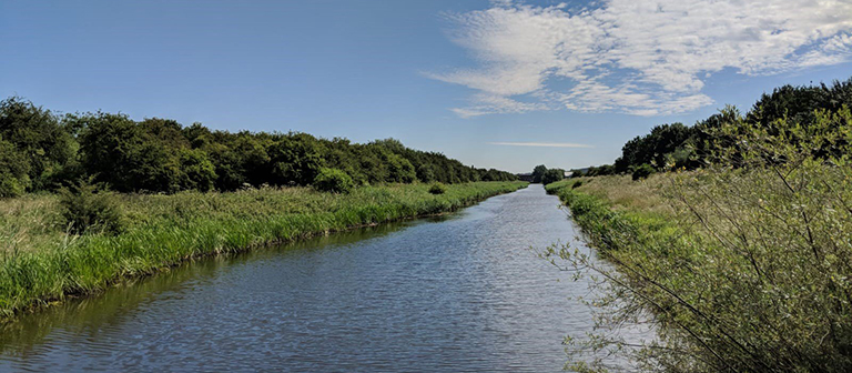
Image of the Snow Sewer Warping Drain in the Isle of Axholme catchment
Selected watercourses in the pilot locations of Stour Marshes, Kent and the Isle of Axholme, North Lincolnshire have officially changed from main river to ordinary watercourse under the Rationalising the Main River Network (RMRN) project. The management of several stretches of watercourse has now been transferred from the Environment Agency to local internal drainage boards (IDBs). All of these sections of watercourse are not associated with major rivers or major population centres, and the changes in designation aim to strengthen local decision making.
- Isle of Axholme, North Lincolnshire – the Isle of Axholme and North Nottinghamshire Water Level Management Board has taken on responsibility for 10.3km of the Snow Sewer Warping Drain, in Owston Ferry, North Lincolnshire as well as the Drain Head Pumping Station.
- Stour Marshes, East Kent – the River Stour (Kent) IDB has taken on responsibility for ten stretches or approximately 36.5km of low risk watercourse across the Stour Marshes.
These stretches add to the watercourses in the South Forty Foot catchment in Lincolnshire, which were successfully transferred to the management of Black Sluice IDB last year.
The Environment Agency has made these transfers as a ‘determination’ under section 193C (1) of the Water Resources Act 1991. These determinations represent a formal decision to change the main river map.
ADA has been supporting the RMRN project, which is about ensuring that the right risk management authorities are managing the right watercourses and assets in the right places. By transferring these watercourses to local partners, the Environment Agency seeks to focus their resources on watercourses and assets that they determine to provide a greater level of flood risk benefit to people and property. For local communities, who have welcomed the change, this re-designation also represents more choice in how their watercourses will be managed and decisions on watercourse maintenance will now be made at a local level by the respective IDBs involved.
The Environment Agency is currently progressing an Evaluation Report for the RMRN project, which will include collated feedback and lessons learned from all of the partners involved.
Categories
Archive
- July 2026
- May 2026
- April 2026
- February 2026
- January 2026
- December 2025
- November 2025
- October 2025
- July 2025
- June 2025
- March 2025
- February 2025
- January 2025
- December 2024
- November 2024
- October 2024
- September 2024
- August 2024
- July 2024
- June 2024
- May 2024
- April 2024
- March 2024
- January 2024
- December 2023
- November 2023
- October 2023
- September 2023
- August 2023
- July 2023
- June 2023
- May 2023
- April 2023
- March 2023
- February 2023
- January 2023
- December 2022
- September 2022
- August 2022
- July 2022
- June 2022
- May 2022
- April 2022
- March 2022
- February 2022
- January 2022
- December 2021
- November 2021
- September 2021
- July 2021
- May 2021
- March 2021
- February 2021
- January 2021
- December 2020
- November 2020
- October 2020
- September 2020
- August 2020
- July 2020
- May 2020
- April 2020
- March 2020
- February 2020
- January 2020
- December 2019
- November 2019
- October 2019
- September 2019
- August 2019
- July 2019
- June 2019
- May 2019
- April 2019
- March 2019
- February 2019
- January 2019
- December 2018
- November 2018
- October 2018
- September 2018
- August 2018
- July 2018
- June 2018
- May 2018
- April 2018
- March 2018
- February 2018
- January 2018
- December 2017
- November 2017
- October 2017
- September 2017
- August 2017
- July 2017
- June 2017
- May 2017
- April 2017
- March 2017
- February 2017
- January 2017
- October 2016
- September 2016
- August 2016
- July 2016
- June 2016
- May 2016
- April 2016
- March 2016
- January 2016