Digital boundaries of every Internal Drainage District published
The Association of Drainage Authorities (ADA) has today published digital vectors of the boundaries of all 113 internal drainage districts in England for the first time. Whilst indicative, this geospatial data is the most comprehensive and consistent national dataset of the administrative boundaries of every internal drainage board (IDB).
Each IDB is a local independent public body that manages water levels in the corresponding internal drainage district. IDBs undertake works to reducing flood risk to people and property, and manage water levels for agricultural needs and for the protection and enhancement of the environment within their district. IDBs are defined as a type of Risk Management Authority under the Flood & Water Management Act 2010.
ADA has worked closely with IDBs and the Environment Agency (EA) to publish this geospatial dataset in an open and accessible format. It is based upon GIS layers and original paper maps gathered directly from IDBs across the country. Digitisation was completed on behalf of ADA by Kate Pollard at the Middle Level Commissioners.
ADA’s Chair, Robert Caudwell, commented: “The publication of this geospatial data is an important step in making IDBs more accessible and visible to the public, developers, environmental partners, and other authorities.”
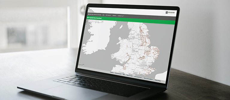
You can download these digital vector boundaries from the Defra Data Services Platform.
What is geospatial data?
Geospatial data is about places. It might be about a specific building, a river or other natural feature, or a broader location like a city or a country. Maps are geospatial data that has been visualised. That same data can be used in many other ways. It can help us find efficient transport routes, plan homes and businesses or identify areas at risk of flooding.
Much of the value of geospatial data comes from using it as raw data that can be used to deliver insights into the state of our natural environment, implement policy and help us make decisions in our daily lives. The most useful insights come from using two or more layers of geospatial data. Combining multiple datasets helps us perform more complex analyses – it means we can explore different aspects of the landscape in which we live and work.
By sharing geospatial data people and organisations within different sectors can gain new insights into the world around us.
Licencing the data
The dataset is licensed under the Open Government Licence 3.0 (OGL). The OGL is a tool developed by the National Archives for public sector bodies to license the re-use of their data easily. It consists of a simple set of terms and conditions to which public sector bodies simply point as the relevant licence.
The OGL does not grant users any right to use the data in a way that suggests any official status or that the provider endorses the user or their use of the data. Users of licenced data must acknowledge the source of the information. The data is licensed ‘as is’ and the data provider is not liable for any errors or omissions in the data, nor for any loss, injury or damage of any kind caused by its use.
Categories
Archive
- July 2026
- May 2026
- April 2026
- February 2026
- January 2026
- December 2025
- November 2025
- October 2025
- July 2025
- June 2025
- March 2025
- February 2025
- January 2025
- December 2024
- November 2024
- October 2024
- September 2024
- August 2024
- July 2024
- June 2024
- May 2024
- April 2024
- March 2024
- January 2024
- December 2023
- November 2023
- October 2023
- September 2023
- August 2023
- July 2023
- June 2023
- May 2023
- April 2023
- March 2023
- February 2023
- January 2023
- December 2022
- September 2022
- August 2022
- July 2022
- June 2022
- May 2022
- April 2022
- March 2022
- February 2022
- January 2022
- December 2021
- November 2021
- September 2021
- July 2021
- May 2021
- March 2021
- February 2021
- January 2021
- December 2020
- November 2020
- October 2020
- September 2020
- August 2020
- July 2020
- May 2020
- April 2020
- March 2020
- February 2020
- January 2020
- December 2019
- November 2019
- October 2019
- September 2019
- August 2019
- July 2019
- June 2019
- May 2019
- April 2019
- March 2019
- February 2019
- January 2019
- December 2018
- November 2018
- October 2018
- September 2018
- August 2018
- July 2018
- June 2018
- May 2018
- April 2018
- March 2018
- February 2018
- January 2018
- December 2017
- November 2017
- October 2017
- September 2017
- August 2017
- July 2017
- June 2017
- May 2017
- April 2017
- March 2017
- February 2017
- January 2017
- October 2016
- September 2016
- August 2016
- July 2016
- June 2016
- May 2016
- April 2016
- March 2016
- January 2016