Online IDB maps go live
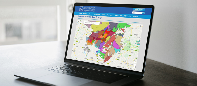
Following detailed behind-the-scenes work, ADA is delighted to announce the launch of a new digital map showing the boundaries of all 112 internal drainage board (IDB) districts in England. The new map can be found on the ADA website, along with contact details for each IDB.
It utilises the Google Maps interface to quickly enable users to zoom in to areas of interest, or to search for locations to find out if they are within or near to an IDB. This versatile tool has been created in conjunction with DigiBubble who built ADA’s current website in 2016. This new online service will be invaluable to members of the public, businesses and authorities who need to quickly find their local IDB.
The map applies a new geographical information system (GIS) layer of IDB boundaries commissioned by ADA in 2017. The ten month project to gather these boundaries, and in some cases digitise them from original maps, was completed by the Middle Level Commissioners in April. This is the first time that the accurate boundaries for all 112 internal drainage districts have been brought together in one place.
ADA hopes that the new opportunities provided by this data will assist better decision making, enabling us, and in time others, to better integrate information about IDBs with other geographical information related to the water environment or the communities they serve. We hope this will enhance the role of IDBs as England’s local water level managers, and make them even more accessible to those who benefit from their work.
ADA invites you to take advantage of the extensive work that has gone into creating this tool. so please visit the new map soon, and provide us with any feedback you may have. Our sincere thanks go to the Middle Level Commissioners, DigiBubble, and every IDB for the access to their data and maps, for the completion of this important project.
Categories
Archive
- July 2026
- May 2026
- April 2026
- February 2026
- January 2026
- December 2025
- November 2025
- October 2025
- July 2025
- June 2025
- March 2025
- February 2025
- January 2025
- December 2024
- November 2024
- October 2024
- September 2024
- August 2024
- July 2024
- June 2024
- May 2024
- April 2024
- March 2024
- January 2024
- December 2023
- November 2023
- October 2023
- September 2023
- August 2023
- July 2023
- June 2023
- May 2023
- April 2023
- March 2023
- February 2023
- January 2023
- December 2022
- September 2022
- August 2022
- July 2022
- June 2022
- May 2022
- April 2022
- March 2022
- February 2022
- January 2022
- December 2021
- November 2021
- September 2021
- July 2021
- May 2021
- March 2021
- February 2021
- January 2021
- December 2020
- November 2020
- October 2020
- September 2020
- August 2020
- July 2020
- May 2020
- April 2020
- March 2020
- February 2020
- January 2020
- December 2019
- November 2019
- October 2019
- September 2019
- August 2019
- July 2019
- June 2019
- May 2019
- April 2019
- March 2019
- February 2019
- January 2019
- December 2018
- November 2018
- October 2018
- September 2018
- August 2018
- July 2018
- June 2018
- May 2018
- April 2018
- March 2018
- February 2018
- January 2018
- December 2017
- November 2017
- October 2017
- September 2017
- August 2017
- July 2017
- June 2017
- May 2017
- April 2017
- March 2017
- February 2017
- January 2017
- October 2016
- September 2016
- August 2016
- July 2016
- June 2016
- May 2016
- April 2016
- March 2016
- January 2016